The Vía de la Estrella or Via da Estrela
An age-old route to reach Santiago
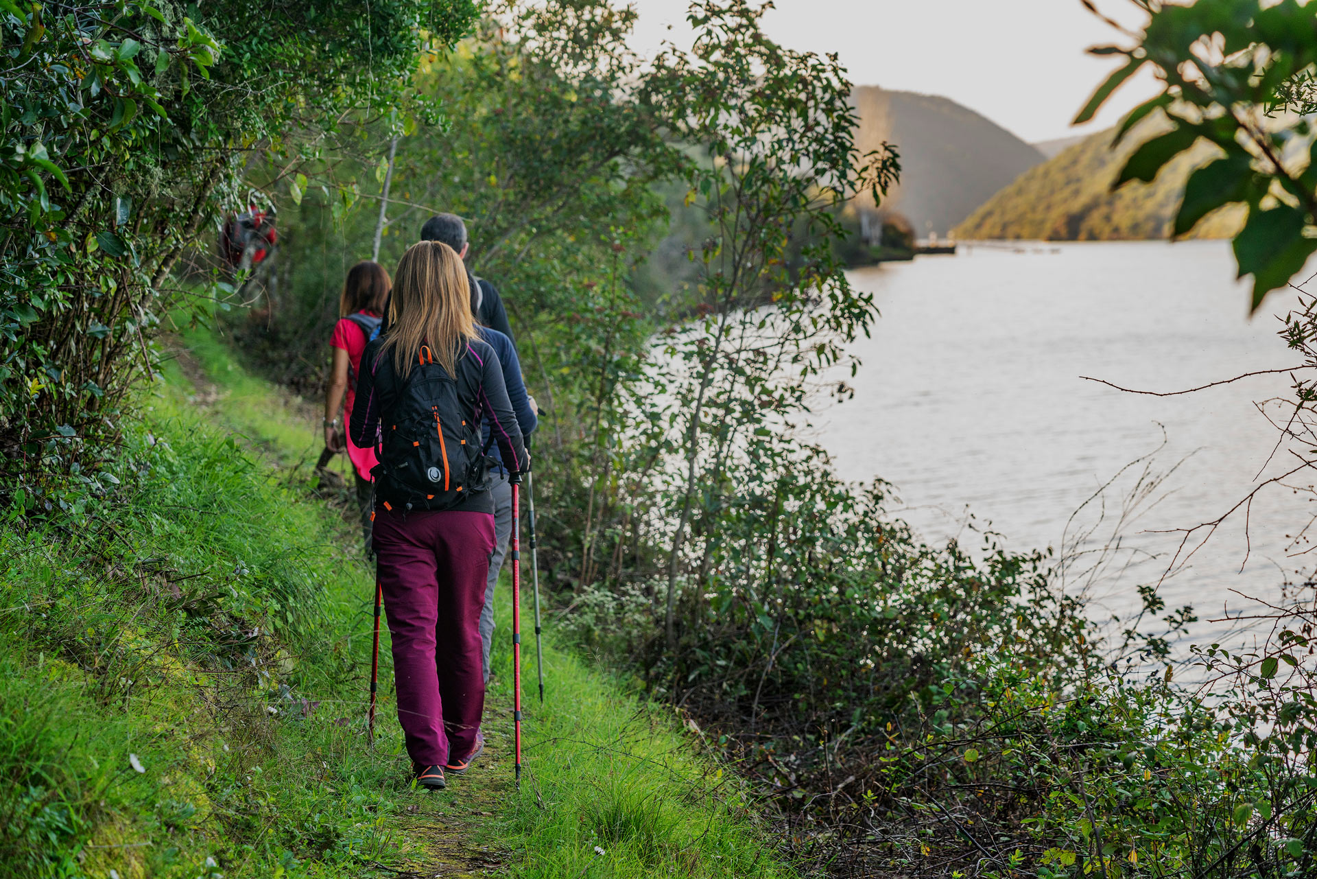
A pilgrim is a traveller who either out of devotion or as a result of a vow visits a sanctuary or a holy place. In Spain the Route to Santiago has been for centuries the axis of Christian pilgrimage. It is of medieval origin and takes us to the tomb of the apostle James in Santiago de Compostela.
Tradition has established several routes for reaching Santiago: the Northern, the French, the Portuguese Route, or the Vía de la Plata among others, all of which have left evidence of an important cultural and spiritual legacy.
These itineraries have now been joined by the revived Vía de la Estrella, a route which originates in the city of Cáceres and starts from the Vía de la Plata. It crosses the Tajo Internacional Biosphere Reserve from southeast to northwest to reach the town of Braga in Portugal where it links up with the Portuguese Route.
The Vía de la Estrella
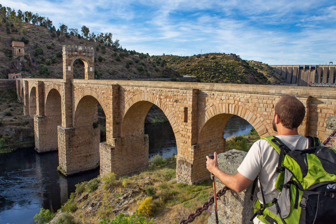
Through the Tajo Internacional runs the Vía de la Estrella, a road of Roman origin which served as an axis of communication of the Iberian Peninsula. To be precise, it linked the cities of Cáceres (Norba Caesarina), Idanha-a-Velha (Igaeditania), Viseu (Beseo), and Braga (Bracara Augusta) with Mérida (Augusta Emerita), which made it for centuries the best communication route between Lusitania and the territories of Galicia. Thanks to this route, in the Middle Ages the headquarters of the Orden of Santiago, i.e. Cáceres, became the meeting point for those travelling to visit the tomb of the apostle James. At that time the most practical way of crossing the River Tajo was by using the famous Bridge of Alcántara as the route was much shorter. With time this historical roadway of passage also became a drovers’ road and was consolidated as the route of transhumance and the wool trade between Extremadura and Portugal.

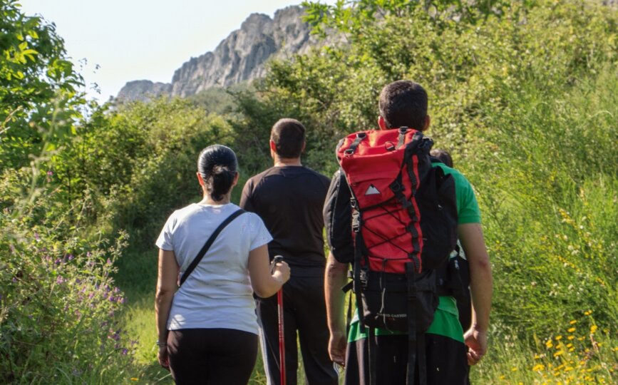
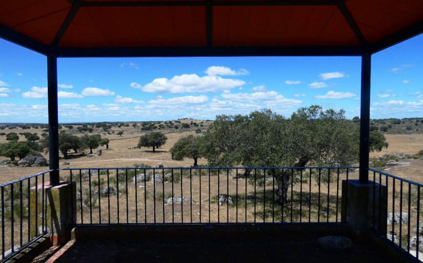
The Vía de la Estrella therefore starts from the historic old quarter of Cáceres to continue via Malpartida de Cáceres, Arroyo de la Luz, Brozas, Villa del Rey, Alcántara, and Piedras Albas to end on the Spanish-Portuguese border on the Roman bridge of Segura. On the way you can enjoy three natural spaces: the plains and the sands of Cáceres, the Natural Monument of Los Barruecos, and the dehesas of the Tajo Internacional Cross-border Biosphere Reserve.
The Vía de la Estrella offers the visitor an incomparable natural setting, bird song, the green shades of the sierra, vast dehesas, and prehistoric, medieval, and Renaissance remains. We will show you the best of each stage:
Arroyo de la Luz-Brozas
We will leave Arroyo by the Las Viñas Trail, passing the Chapel of the Virgen de la Luz with its magnificent dehesa and its Visigothic necropolis. On the way we will come across evidence of the late Roman period in the form of: villas and anthropomorphous tombs. Further on we will find the natural spectacle of the Plasencia-Alentejo fault right on the Araya Stream and also many impressive dolmens. The skies of this ZEPA are full of interesting birds. After crossing a landscape of holm and cork oaks we come to Brozas, a town full of monuments in the form of stately homes, mansions, and churches.
Brozas-Alcántara
On the Los Charros Drovers’ Road you will pass the impressive Torre de Belvís which belonged to the Order of Alcántara. Then take the Cruz de Alcántara Trail and the Tajo Internacional Cross-border Biosphere Reserve will welcome you. Now you are immersed in the peneplain which forms part of the Natura 2000 Network All of this territory is a ZEPA dominated by birds of the steppe such as the great bustard, little bustard, and sandgrouse.
Alcántara- Segura
Pass through the walls of this town and follow the Roman road until you reach the imposing Roman Bridge. It will delight you, especially as you can cross it on foot until you come to the junction of the Cruce de la Batalla, where again you will find Roman remains in the form of a roadway of slate slabs which was restored in the Middle Ages.
Now it is time to enjoy the heart of the Tajo Internacional Biosphere Reserve and explore the Alcántara or Gata Royal Drovers’ Road to Piedras Albas. Halfway along the route you can make a short detour to the hamlet of Estorninos to rest in the shade of the Church of Santiago and the Humilladero shrine. Here the dehesa conceals cave engravings and prehistoric remains such as the Menhir el Cabezo.
The Vía de la Estrella in Portugal
You have reached the Portuguese section of this itinerary. From now on you can continue your adventure to Braga in order to reach Santiago de Compostela. Find out about the state of the trail in Portugal at the Tourist Office of Idanha-a-Nova (00 351) 277 202 900.